GAP_P4の概要
データの詳細 (GAP_P4)
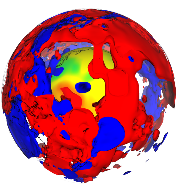
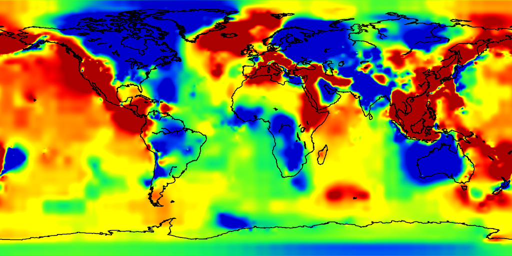
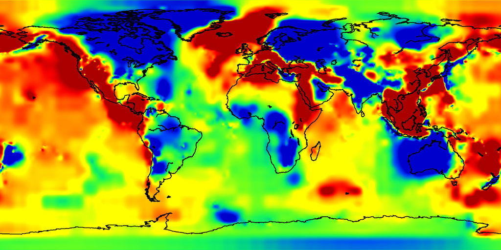
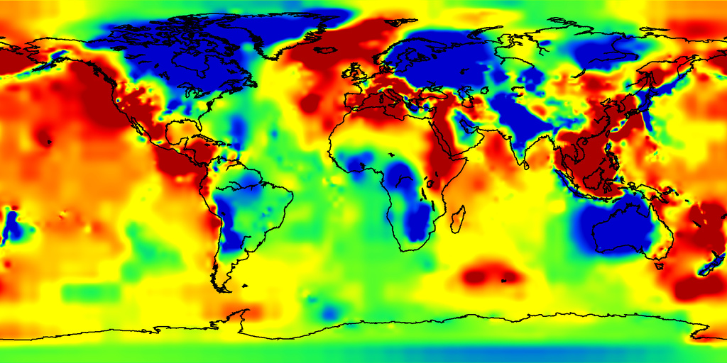
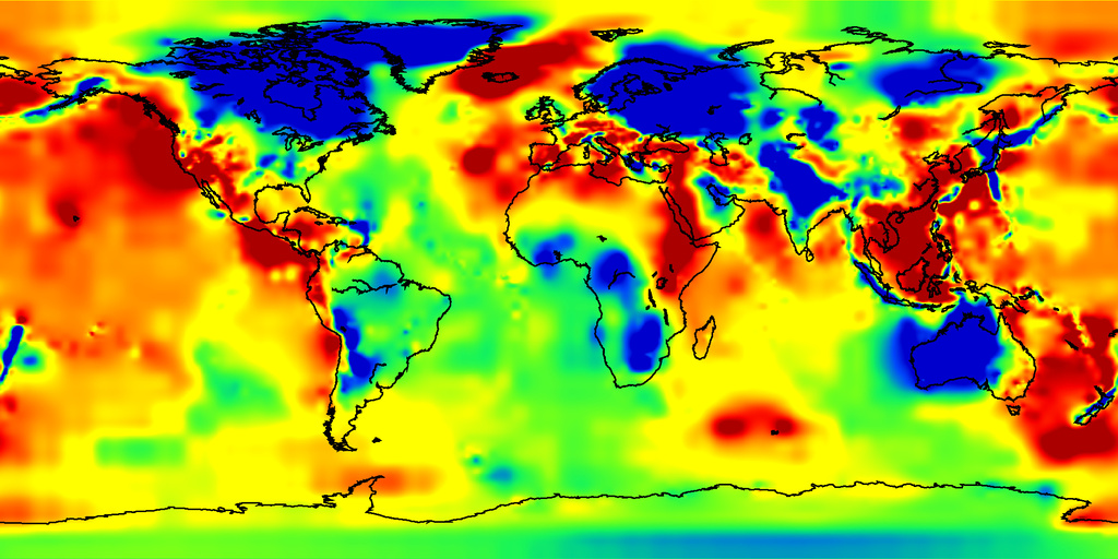
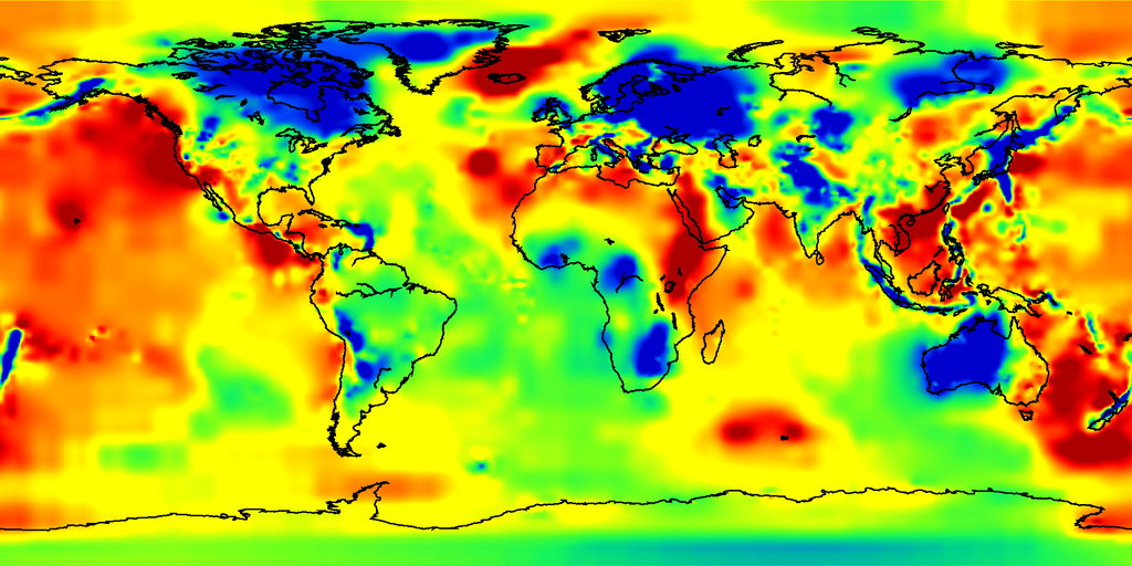
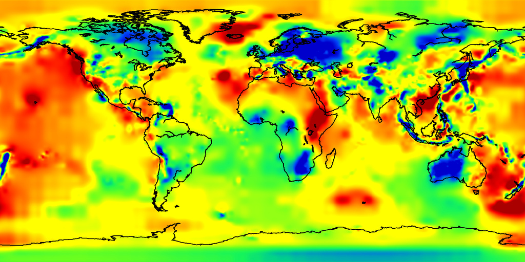
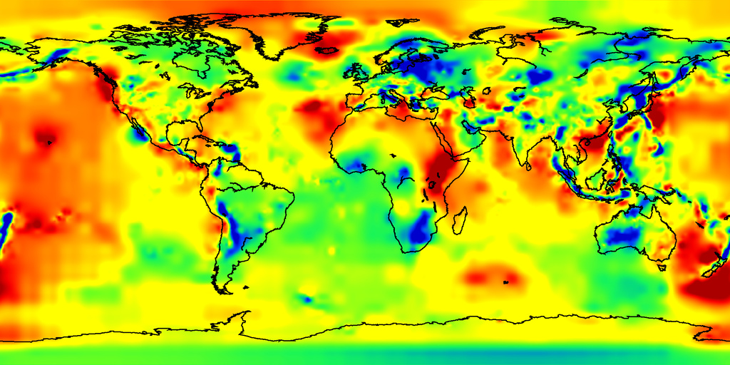
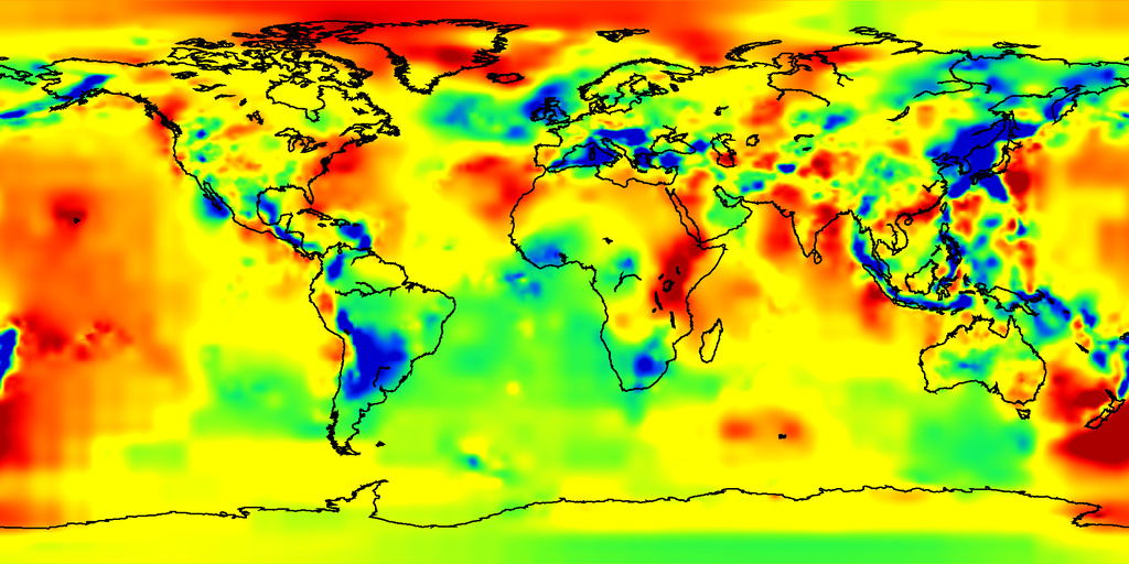
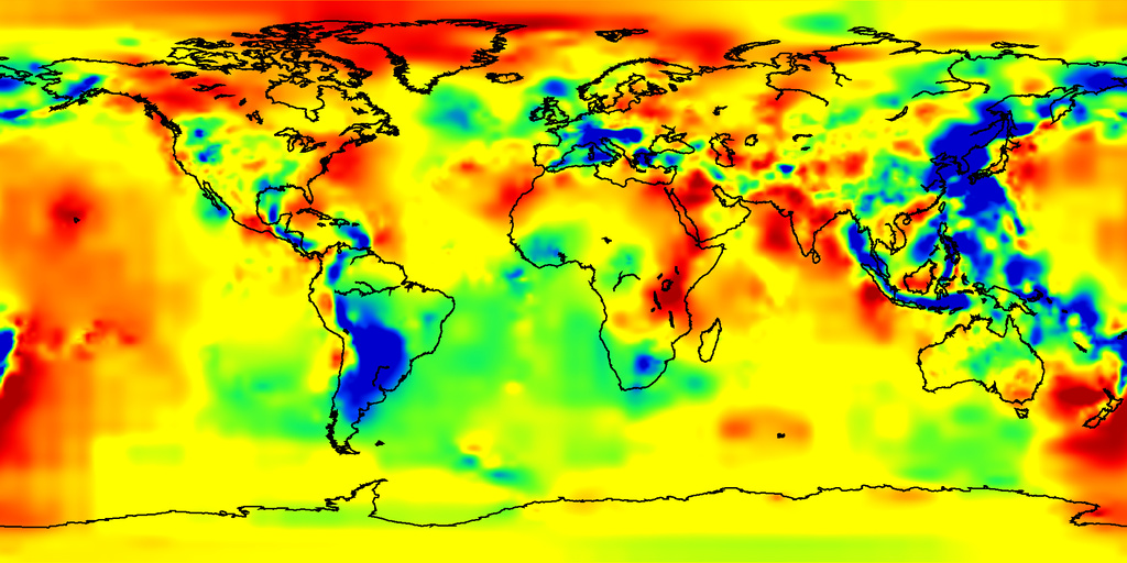
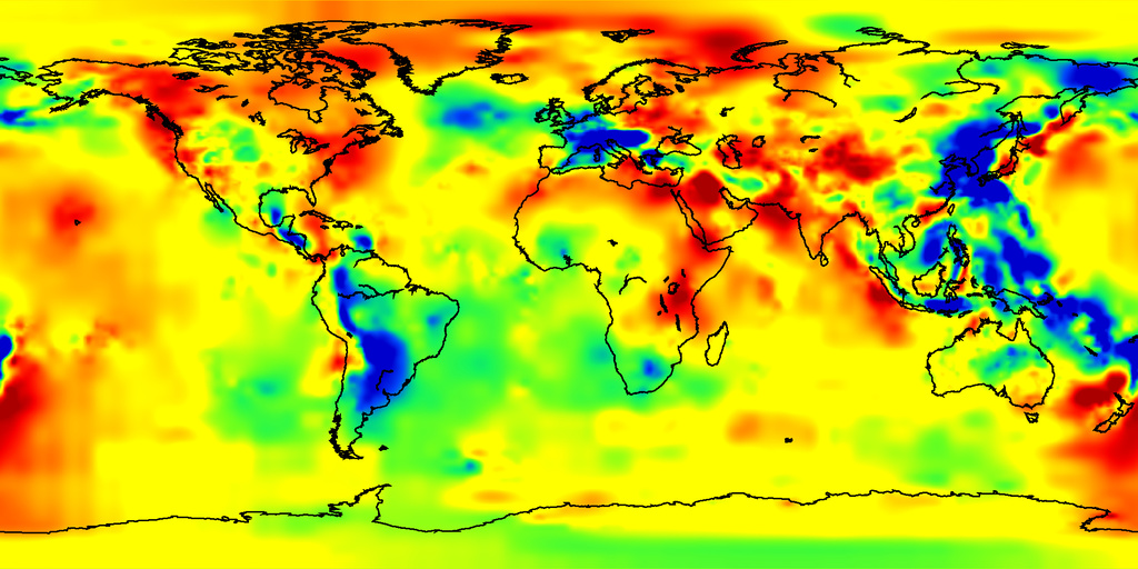
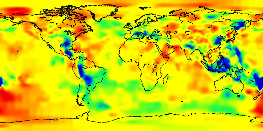
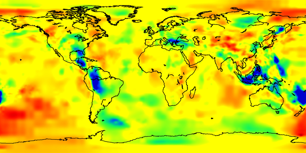
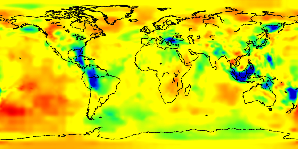
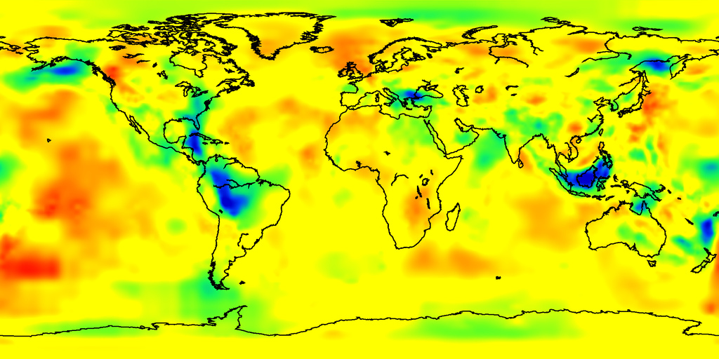
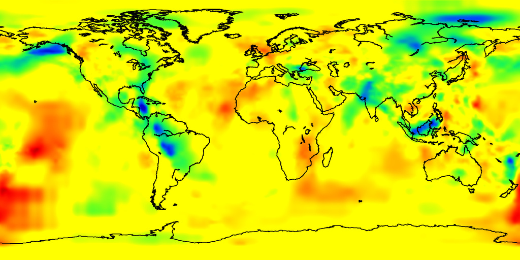
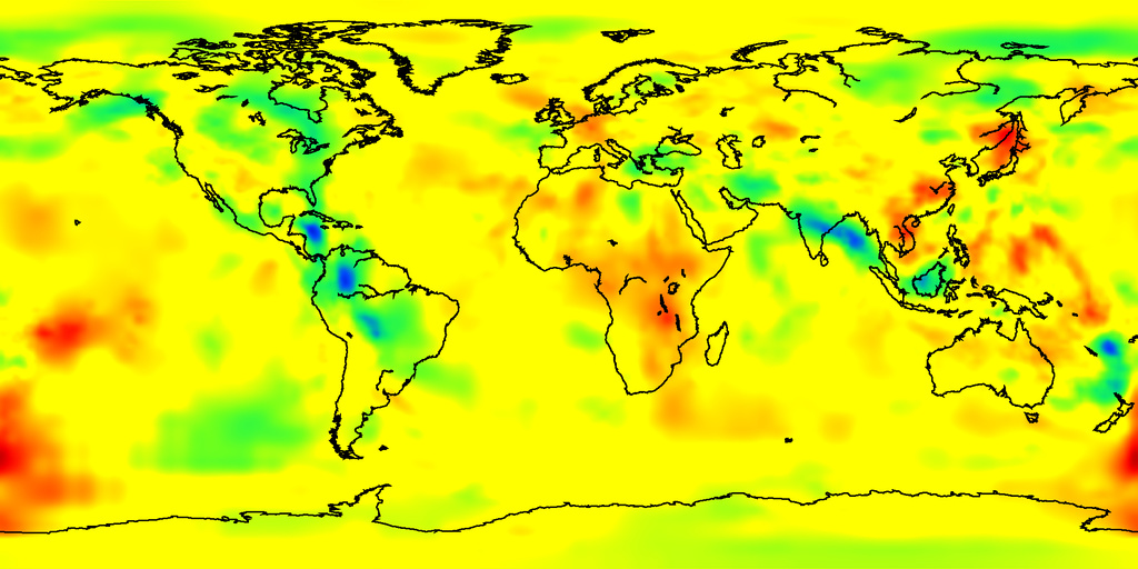
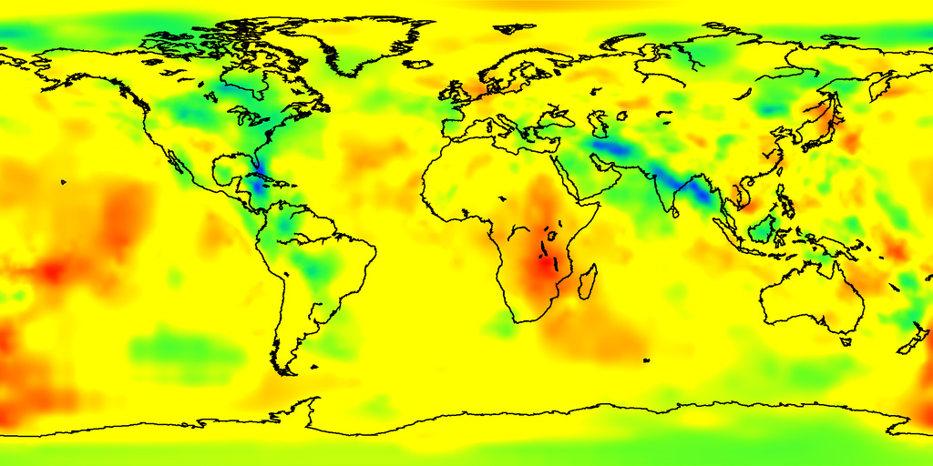
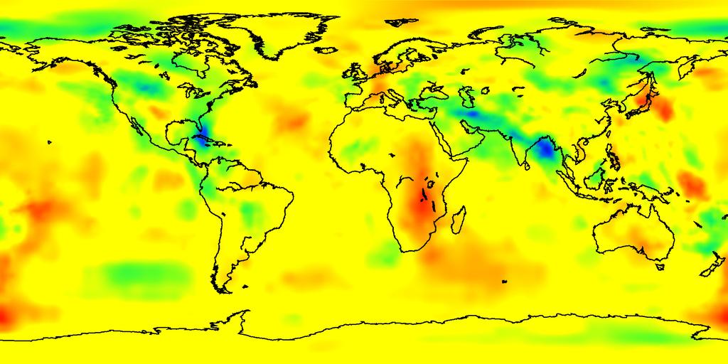
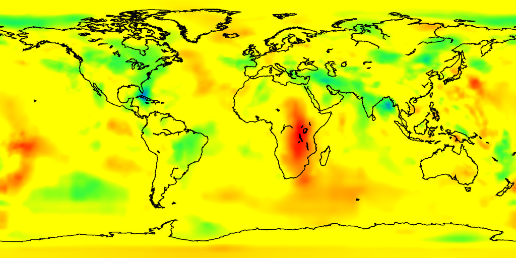
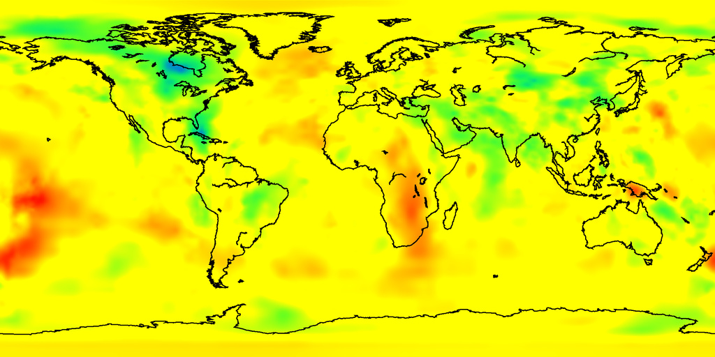
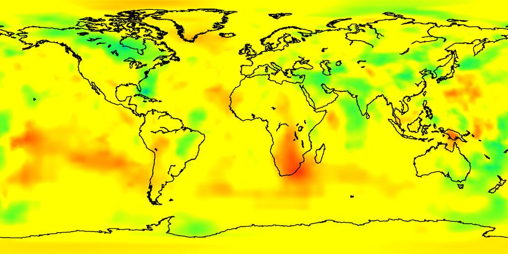
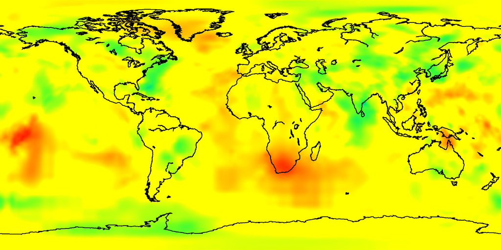
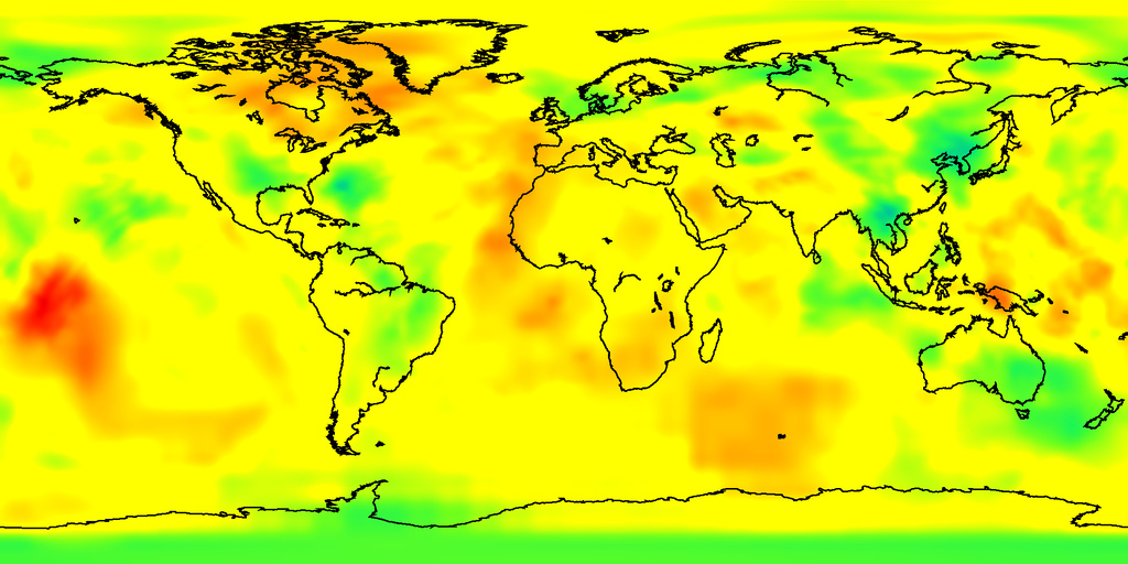
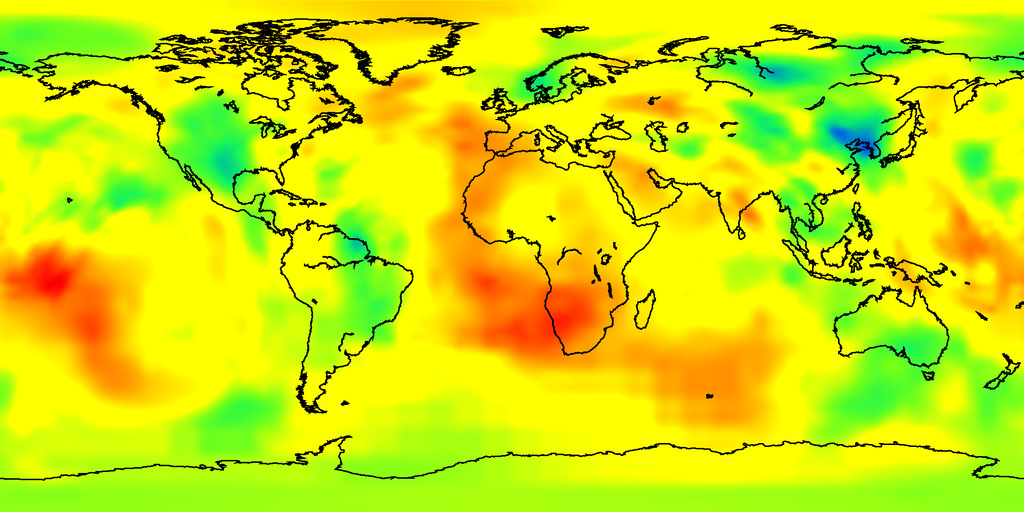
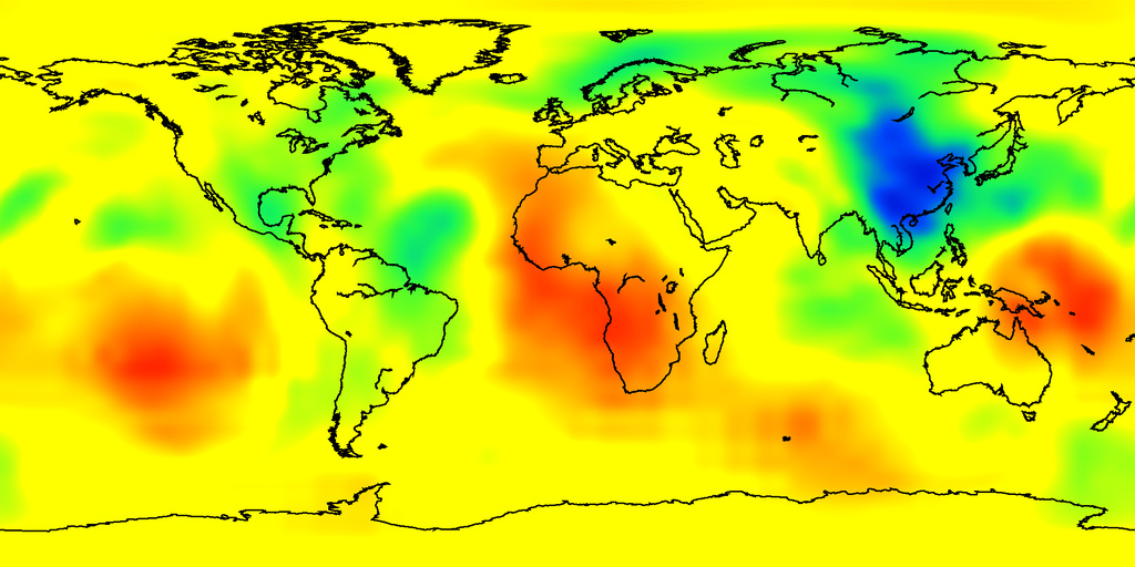
地震波トモグラフィーモデル
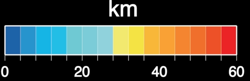
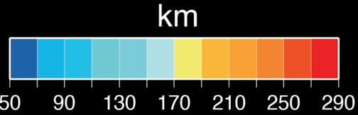
カラースケール
- P-wave (ダウンロード カラーバー (eps))
地震波トモグラフィーモデル: GAP_P4 (P波の速度偏差), Obayashi M. et al., Finite frequency whole mantle P-wave tomography: Improvement of subducted slab, Geophys. Res. Lett., (2013), Fukao Y., M. Obayashi, Subducted slabs stagnant above, penetrating through and trapped below the 660-km discontinuity. J. Geophys. Res., (2013)
The horizontal resolusion is reduced from the original 576 x 288 (longitude x latitude) to 288 x 144.
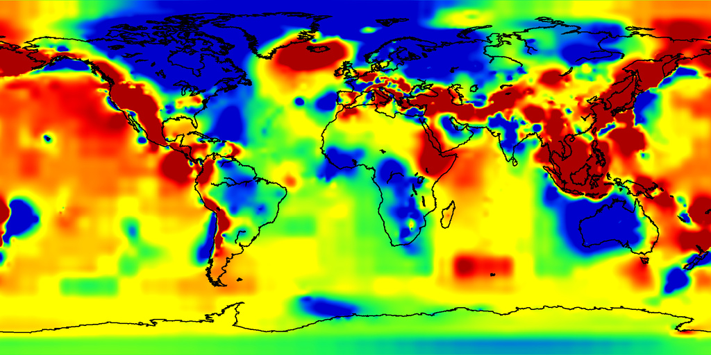
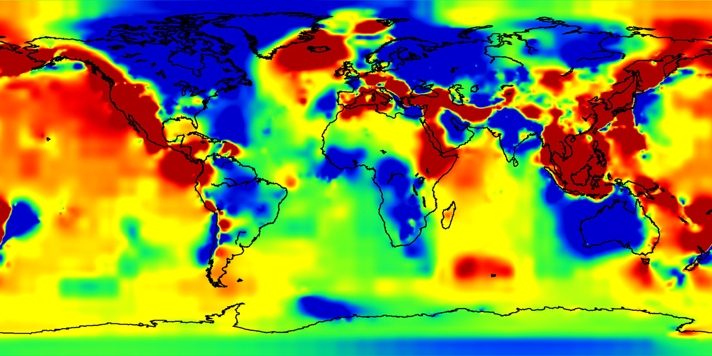
等深度面のテクスチャマップ
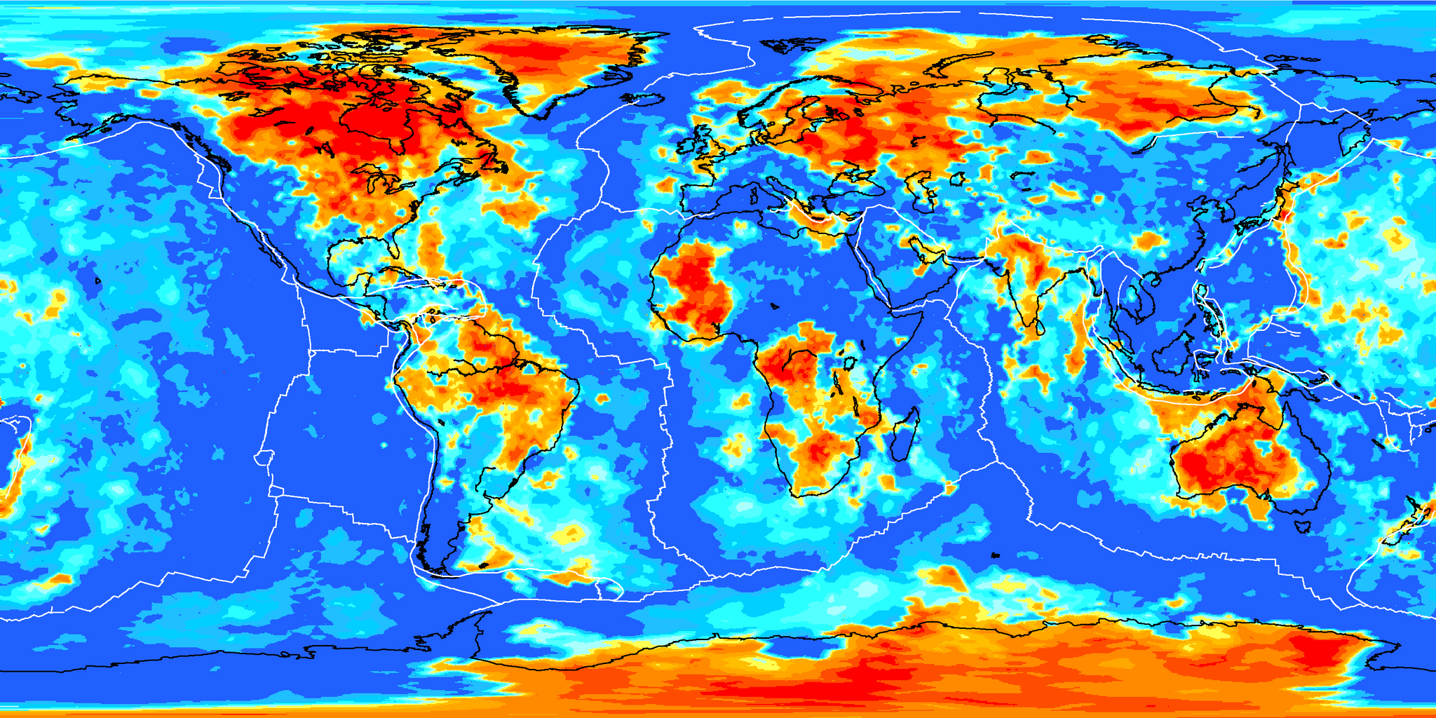
P波速度のマップ(深さ): 29-51 km, 51-78 km, 78-110 km, 110-148 km, 148-190 km, 190-238 km, 238-290 km, 290-348 km, 348-410 km, 410-478 km, 478-551 km, 551-629 km, 629-712 km, 712-800 km, 800-893 km, 893-991 km, 991-1095 km, 1095-1203 km, 1203-1317 km, 1317-1435 km, 1435-1559 km, 1559-1688 km, 1688-1821 km, 1821-1960 km, 1960-2104 km, 2104-2253 km, 2253-2407 km, 2407-2566 km, 2566-2891 km,
地球表層データについて
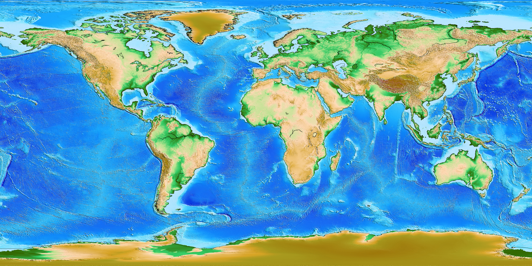
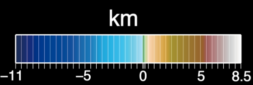
標高データ(topography): ETOPO1
Moho面の深さ(MohoDepth): CRUST1.0
リソスフェア・アセノスフェア境界の深さ(LA_Depth): LITHO1.0 (Tessellation level 7)
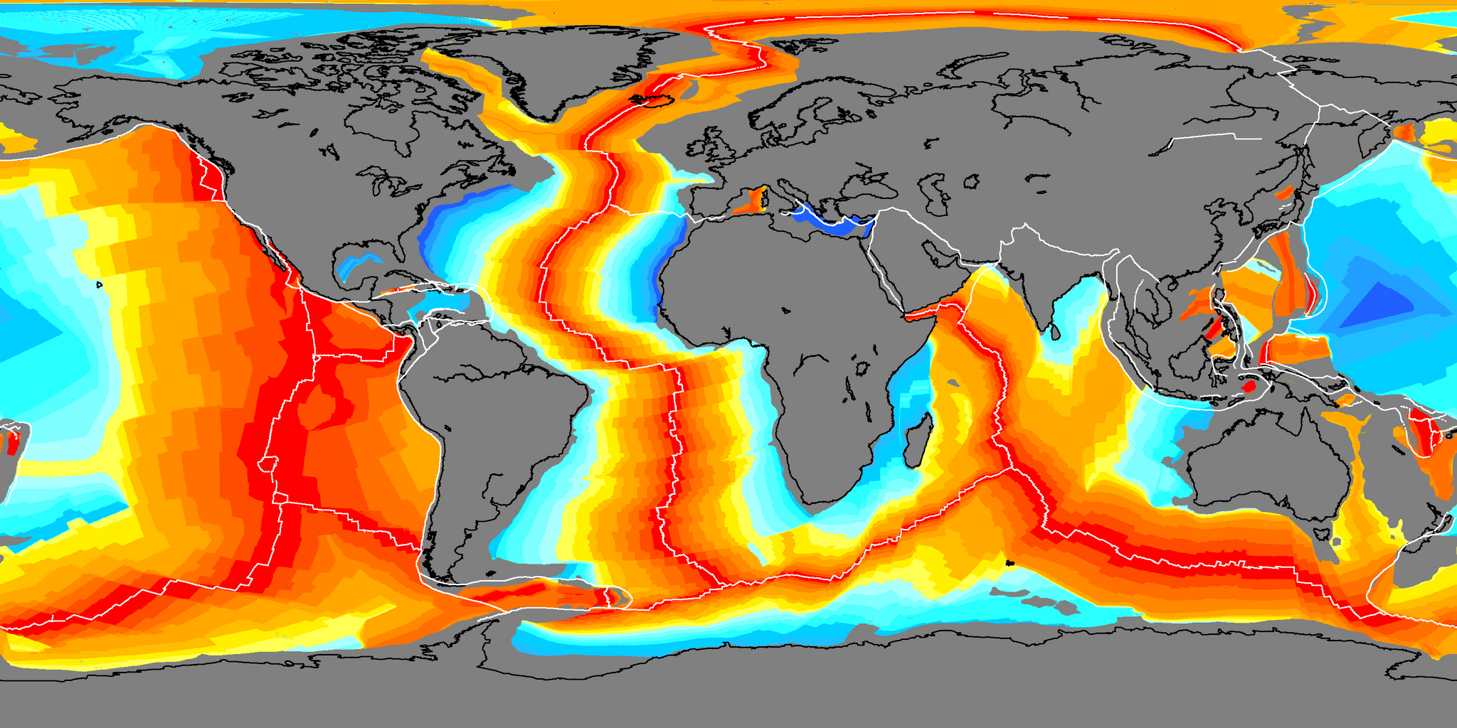
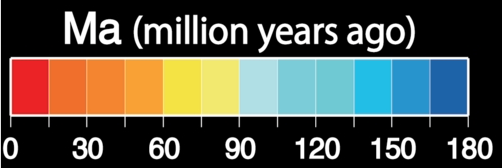
海底の形成年代(oceanFloorAge): Agegrid (Earth Byte)
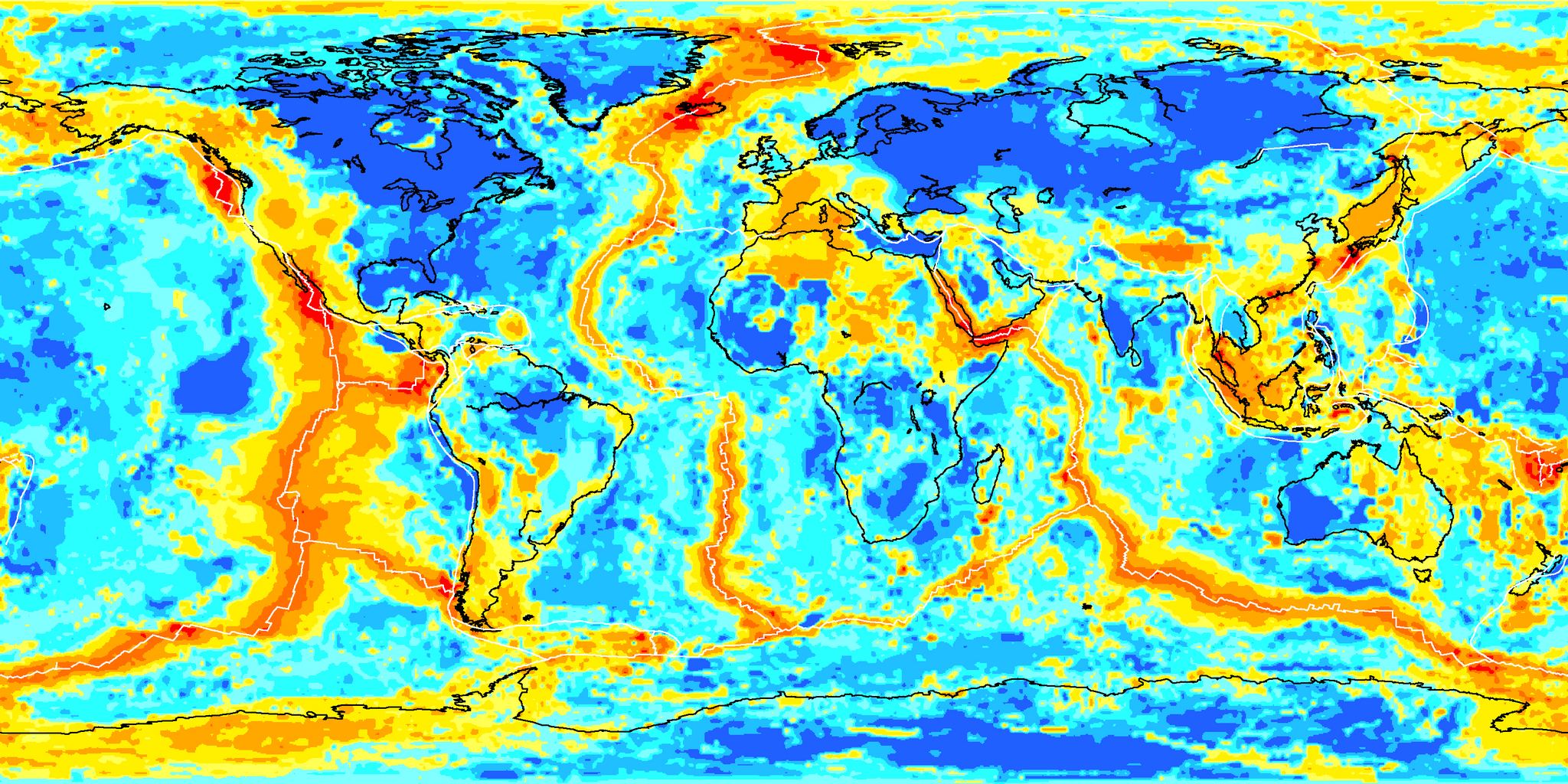
地殻熱流量(heatFlow)
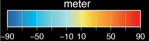
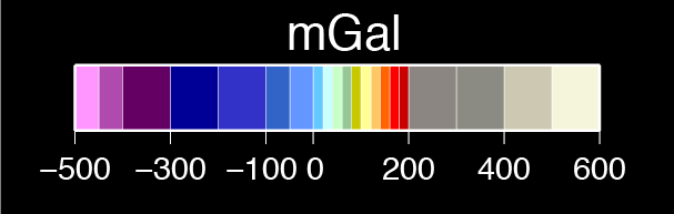
ジオイドの高さ(geoidHeight): EGM2008
フリーエア(FA_GravityAnormaly)およびブーゲー重力異常(BouguerAnormaly): WGM2012
Amante, C; Eakins, B W (2009): ETOPO1, Global Relief Model converted to PanMap layer format. NOAA-National Geophysical Data Center, PANGAEA, doi:10.1594/PANGAEA.769615 (ダウンロード カラーバー (eps), テクスチャ (jpg))
Laske, G., Masters., G., Ma, Z. and Pasyanos, M., Update on CRUST1.0 - A 1-degree Global Model of Earth's Crust, Geophys. Res. Abstracts, 15, Abstract EGU2013-2658, 2013 (ダウンロード カラーバー (eps), テクスチャ (jpg))
Pasyanos, M.E., T.G. Masters, G. Laske, and Z. Ma (2014). LITHO1.0: An updated crust and lithospheric model of the Earth, J. Geophys. Res., 119 (3), 2153-2173, DOI: 10.1002/2013JB010626 (ダウンロード カラーバー (eps), テクスチャ (jpg))
Müller, R.D., M. Sdrolias, C. Gaina, and W.R. Roest 2008. Age, spreading rates and spreading symmetry of the world's ocean crust, Geochem. Geophys. Geosyst., 9, Q04006, doi:10.1029/2007GC001743 (ダウンロード カラーバー (eps), テクスチャ (jpg))
Goutorbe, B., J. Poort, F. Lucazeau, and S. Raillard (2011), Global heat flow trends resolved from multiple geological and geophysical proxies, Geophys. J. Int., 187, 1405–1419 (ダウンロード カラーバー (eps), テクスチャ (jpg))
Nikolaos K. Pavlis, Simon A. Holmes, Steve C. Kenyon, John K. Factor, The development and evaluation of the Earth Gravitational Model 2008 (EGM2008), Journal of Geophysical Research: Solid Earth, 117, B4, 2012 (ダウンロード カラーバー (eps), テクスチャ (jpg))
Balmino, G., Vales, N., Bonvalot, S. and Briais, A., 2011. Spherical harmonic modeling to ultra-high degree of Bouguer and isostatic anomalies. Journal of Geodesy. DOI 10.1007/s00190-011-0533-4 (ダウンロード カラーバー (eps), テクスチャ (jpg) (フリーエア異常 ), カラーバー (eps), テクスチャ (jpg)(ブーゲー異常))
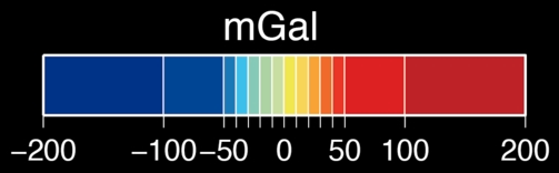
フリーエア異常
ブーゲー異常
マップの作成について
等深度面画像については、Generic Mapping Tool (GMT)を使用して作成しました(雲を含む画像を除く)。
GMT: Wessel,P. and W.H.F.Smith, New, improved version of Generic Mapping Tools released, EOS Trans. Amer. Geophys. U., vol.79 (47), pp.579, 1998
雲を含む画像 (earthWithCloud): Tom Patterson, www.shadedrelief.com