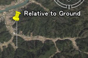
最初の2行と最後の1行は、KMLの開始と終了を示すので、変更しない。行頭などに空白も入れない。
高度は、後述の"<altitudeMode>"を指定しないと、無視され、地表にマークが置かれる。
<?xml version="1.0" encoding="UTF-8"?>
<kml xmlns="http://earth.google.com/kml/2.0"> <Document>

<Placemark>
 <Point>
  <coordinates>
   135.2,35.4,0.
  </coordinates>
 </Point>
</Placemark>

</Document> </kml>
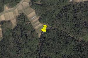
タグの大文字と小文字は区別されるので注意。
<?xml version="1.0" encoding="UTF-8"?>
<kml xmlns="http://earth.google.com/kml/2.0"> <Document>

<Placemark>
 <name> New point</name>
 <Point>
  <coordinates>
   135.2,35.4,0.
  </coordinates>
 </Point>
</Placemark>

</Document> </kml>
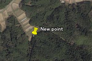
<?xml version="1.0" encoding="UTF-8"?>
<kml xmlns="http://earth.google.com/kml/2.0"> <Document>

<Placemark>
 <name> New point</name>
 <description>This is a new point.</description>
 <Point>
  <coordinates>
   135.2,35.4,0.
  </coordinates>
 </Point>
</Placemark>

</Document> </kml>
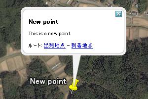
<?xml version="1.0" encoding="UTF-8"?>
<kml xmlns="http://earth.google.com/kml/2.0"> <Document>

<Style id="My_Style">
 <IconStyle> <Icon> <href>ball.png</href> </Icon></IconStyle>
</Style>

<Placemark>
 <name> New point</name>
 <description>This is a new point to learn KML format.</description>
 <styleUrl> #My_Style</styleUrl>
 <Point>
  <coordinates>
   135.2,35.4,0.
  </coordinates>
 </Point>
</Placemark>

</Document> </kml>
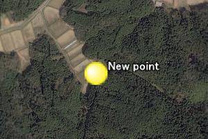
"ball.png"を上のkmlファイルと同じフォルダに置いておく。
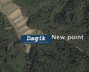
"http://step0ku.kugi.kyoto-u.ac.jp/dagik/kml_intro/ball.png"などのようにネットワーク上の画像も使える。
"styleUrl"では、ネットワーク上のstyleファイルを指定することもできる。
画像もファイルに含めるにはzipでkmlファイルと画像ファイルをまとめて一つのファイルにし、拡張子を"kmz"にする。
<?xml version="1.0" encoding="UTF-8"?>
<kml xmlns="http://earth.google.com/kml/2.0"> <Document>
<Style id="My_Style">
<IconStyle> <Icon> <href>ball.png</href> </Icon>

<scale>5.0</scale>

</IconStyle>
</Style>

<Placemark>
 <name> New point</name>
 <description>This is a new point to learn KML format.</description>
<styleUrl> #My_Style</styleUrl>
 <Point>
  <coordinates>
   135.2,35.4,0.
  </coordinates>
 </Point>
</Placemark>

</Document> </kml>

<?xml version="1.0" encoding="UTF-8"?>
<kml xmlns="http://earth.google.com/kml/2.0"> <Document>
<Style id="My_Style">
<IconStyle> <Icon> <href>
 http://dagik.org/images/dagik_logo.png
</href> </Icon>
</IconStyle>
</Style>

<Placemark>
 <name> New point</name>
 <description>This is a new point to learn KML format.</description>
<styleUrl> #My_Style</styleUrl>
 <Point>
  <coordinates>
   135.2,35.4,0.
  </coordinates>
 </Point>
</Placemark>

</Document> </kml>
<?xml version="1.0" encoding="UTF-8"?>
<kml xmlns="http://earth.google.com/kml/2.0"> <Document>

<Style id="My_Style">
 <IconStyle> <Icon> <href>ball.png</href> </Icon></IconStyle>
 <BalloonStyle>
  <bgColor>00664422</bgColor>
  <text><![CDATA[ $[name] <HR> $[description] <BR>
   <A HREF="http://step0ku.kugi.kyoto-u.ac.jp/">SPEL Home page</A>
  ]]> </text>
 </BalloonStyle>
</Style>

<Placemark>
 <name> New point</name>
 <description>This is a new point to learn KML format.</description>
 <styleUrl> #My_Style</styleUrl>
 <Point>
  <coordinates>
   135.2,35.4,0.
  </coordinates>
 </Point>
</Placemark>

</Document> </kml>
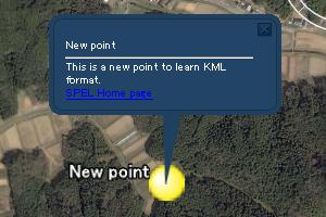 "<Placemark>"の中の"<name>"は"$[name]"、"<description>"は"$[description]"で引用できる。
"<![CDATA["と"]]>" の間はHTMLと解釈されるので、HREF, IMGなどのHTMLが使え、リンクや画像が置ける。
<?xml version="1.0" encoding="UTF-8"?>
<kml xmlns="http://earth.google.com/kml/2.0"> <Document>

<Style id="My_Style">
 <IconStyle> <Icon> <href>ball.png</href> </Icon></IconStyle>
 <BalloonStyle>
  <bgColor>00664422</bgColor>
  <text><![CDATA[ $[name] <HR> $[description] <BR>
   <A HREF="http://step0ku.kugi.kyoto-u.ac.jp/">SPEL Home page</A>
  ]]> </text>
 </BalloonStyle>
</Style>

<Placemark>
 <name> New point</name>
 <TimeSpan>
  <begin>2015-12-08T07:00:00Z</begin>
  <end>2015-12-08T07:59:59Z</end>
 </TimeSpan>
 <description>This is a new point to learn KML format.</description>
 <styleUrl> #My_Style</styleUrl>
 <Point>
  <coordinates>
   135.2,35.4,0.
  </coordinates>
 </Point>
</Placemark>

</Document> </kml>
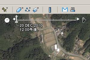 左上に時間のスライドバーが現れる
"YYYY-MM-DDTHH:MM:SSZ"でUTでの時刻を設定できる。
" <begin>"で表示開始時間、 "<end>”で表示終了時間を指定する。
<?xml version="1.0" encoding="UTF-8"?>
<kml xmlns="http://earth.google.com/kml/2.0"> <Document>

<Placemark>
 <name> Mark in the air</name>
 <Point>
  <coordinates>
   135.2,35.4,1000.
  </coordinates>
  <altitudeMode>absolute</altitudeMode>
 </Point>
</Placemark>

</Document> </kml>
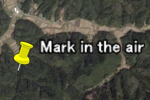
単位はメートル
地表面からの相対的な高さにする場合は"<altitudeMode>relativeToGround</altitudeMode>"
