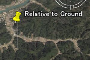
Altitude is ignored when "<altitudeMode>", which is discribed below, is not specified.
<?xml version="1.0" encoding="UTF-8"?>
<kml xmlns="http://earth.google.com/kml/2.0"> <Document>

<Placemark>
 <Point>
  <coordinates>
   135.2, 35.4, 0.
  </coordinates>
 </Point>
</Placemark>

</Document> </kml>
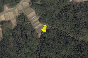
The first two lines and the last line are the begin and end of KML file, respectively. Just keep as they are.
The tags of KML is case sensitive.
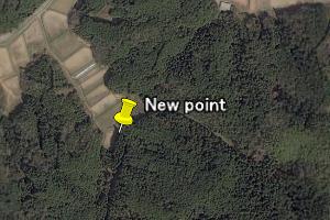
<?xml version="1.0" encoding="UTF-8"?>
<kml xmlns="http://earth.google.com/kml/2.0"> <Document>

<Placemark>
 <name> New point</name>
 <Point>
  <coordinates>
   135.2, 35.4, 0.
  </coordinates>
 </Point>
</Placemark>

</Document> </kml>
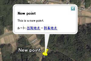
<?xml version="1.0" encoding="UTF-8"?>
<kml xmlns="http://earth.google.com/kml/2.0"> <Document>

<Placemark>
 <name> New point</name>
 <description>This is a new point.</description>
 <Point>
  <coordinates>
   135.2, 35.4, 0.
  </coordinates>
 </Point>
</Placemark>

</Document> </kml>
<?xml version="1.0" encoding="UTF-8"?>
<kml xmlns="http://earth.google.com/kml/2.0"> <Document>

<Style id="My_Style">
 <IconStyle> <Icon> <href>ball.png</href> </Icon></IconStyle>
</Style>

<Placemark>
 <name> New point</name>
 <description>This is a new point to learn KML format.</description>
 <styleUrl> #My_Style</styleUrl>
 <Point>
  <coordinates>
   135.2, 35.4, 0.
  </coordinates>
 </Point>
</Placemark>

</Document> </kml>
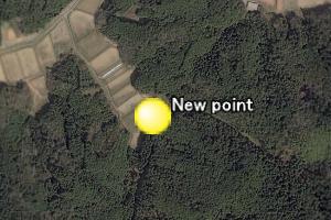
Save "ball.png" in the same folder with the above kml file.
Image file can be a file on WWW, such as "http://www...../ball.png" .
"styleUrl" can also be a style file on WWW.
To make one file with image files and kml file, combine the kml file and image files with "zip" command, and
set the extension ".kmz", such as "test.kmz".
<?xml version="1.0" encoding="UTF-8"?>
<kml xmlns="http://earth.google.com/kml/2.0"> <Document>

<Style id="My_Style">
 <IconStyle> <Icon> <href>ball.png</href> </Icon></IconStyle>
 <BalloonStyle>
  <bgColor>00664422</bgColor> <textColor>fffffff</textColor>
  <text><![CDATA[ $[name] <HR> $[description] <BR>
   <A HREF="http://www-step.kugi.kyoto-u.ac.jp/">SPEL Home page</A>
  ]]> </text>
 </BalloonStyle>
</Style>

<Placemark>
 <name> New point</name>
 <description>This is a new point to learn KML format.</description>
 <styleUrl> #My_Style</styleUrl>
 <Point>
  <coordinates>
   135.2, 35.4, 0.
  </coordinates>
 </Point>
</Placemark>

</Document> </kml>
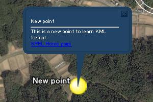
"<name>" and "<description>" written in "<Placemark>" can be referred by "$[name]" and "$[description]", resepectively.
<?xml version="1.0" encoding="UTF-8"?>
<kml xmlns="http://earth.google.com/kml/2.0"> <Document>

<Style id="My_Style">
 <IconStyle> <Icon> <href>ball.png</href> </Icon></IconStyle>
 <BalloonStyle>
  <bgColor>00664422</bgColor> <textColor>fffffff</textColor>
  <text><![CDATA[ $[name] <HR> $[description] <BR>
   <A HREF="http://www-step.kugi.kyoto-u.ac.jp/">SPEL Home page</A>
  ]]> </text>
 </BalloonStyle>
</Style>

<Placemark>
 <name> New point</name>
 <TimeSpan>
  <begin>2010-12-20T03:00:00Z</begin>
  <end>2010-12-21T02:59:59Z</end>
 </TimeSpan>
 <description>This is a new point to learn KML format.</description>
 <styleUrl> #My_Style</styleUrl>
 <Point>
  <coordinates>
   135.2, 35.4, 0.
  </coordinates>
 </Point>
</Placemark>

</Document> </kml>
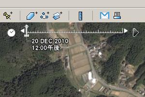
Time in Universal Time (UT) can be set by "YYYY-MM-DDTHH:MM:SSZ".
Start and end time are set by " <begin>" and "<end>”, respectively.

